Rising 2,381 meters above the Salvadoran highlands, Santa Ana Volcano — known locally as Ilamatepec — harbors one of the most stunning crater lakes in the entire Western Hemisphere. Beneath its deceptively serene surface lies a restless giant whose eruptions have shaped civilizations, landscapes, and legends for thousands of years.
Santa Ana Volcano emerged from the volatile subduction zone where the Cocos tectonic plate dives beneath the Caribbean plate, a geological process that has been sculpting Central America for millions of years. As the highest volcano in El Salvador and the centerpiece of what is now Santa Ana Volcano National Park, Ilamatepec — its indigenous Nahuatl name meaning 'Old Woman's Hill' or 'Hill of the Old Water Lady' — began forming during the Pleistocene epoch. Its layered stratovolcano structure, built from successive flows of andesite and basalt, tells a story of repeated explosive cycles that predate human settlement in the region by hundreds of thousands of years.
Geological surveys reveal that Santa Ana's volcanic complex is part of a broader system that includes neighboring Cerro Verde and Izalco, the so-called 'Lighthouse of the Pacific.' Early eruption sequences deposited thick ignimbrite layers across the surrounding valleys, creating the extraordinarily fertile soils that would later attract pre-Columbian agricultural communities. The volcano's multiple nested craters — a telltale sign of repeated caldera collapses and rebuilding — speak to an ancient rhythm of destruction and regeneration. Scientists have identified at least four major eruptive periods in the Holocene era, each one dramatically reshaping the surrounding landscape and leaving behind mineral-rich deposits still visible along hiking trails today.
Long before Spanish conquistadors arrived in the sixteenth century, the indigenous Pipil and Lenca peoples who inhabited the highlands surrounding Ilamatepec regarded the volcano with a mixture of reverence and fear. The Nahuatl name itself reflects a deep spiritual connection — the 'Old Woman' was understood as a powerful maternal deity, a provider of water and fertility whose anger manifested in eruption and whose calm brought agricultural abundance. Offerings and ceremonial sites discovered near the volcano's base suggest sustained ritual activity stretching back at least to the Classic Maya period, roughly 250 to 900 CE, when the broader region was integrated into extensive Mesoamerican trade and cultural networks.
When Pedro de Alvarado led Spanish forces into what is now El Salvador in 1524, the volcanic highlands were home to densely settled Pipil communities that had cultivated cacao, maize, and indigo across the fertile lower slopes of Ilamatepec for generations. The conquistadors, fixated on the region's agricultural wealth rather than its volcanic geology, renamed the mountain Santa Ana in honor of the nearby colonial city they founded. This renaming represented a deliberate act of cultural overwriting, layering a Catholic identity over an indigenous spiritual landscape. Nevertheless, local communities continued to use the name Ilamatepec informally, preserving a thread of pre-Columbian identity that persists in Salvadoran culture to this day.
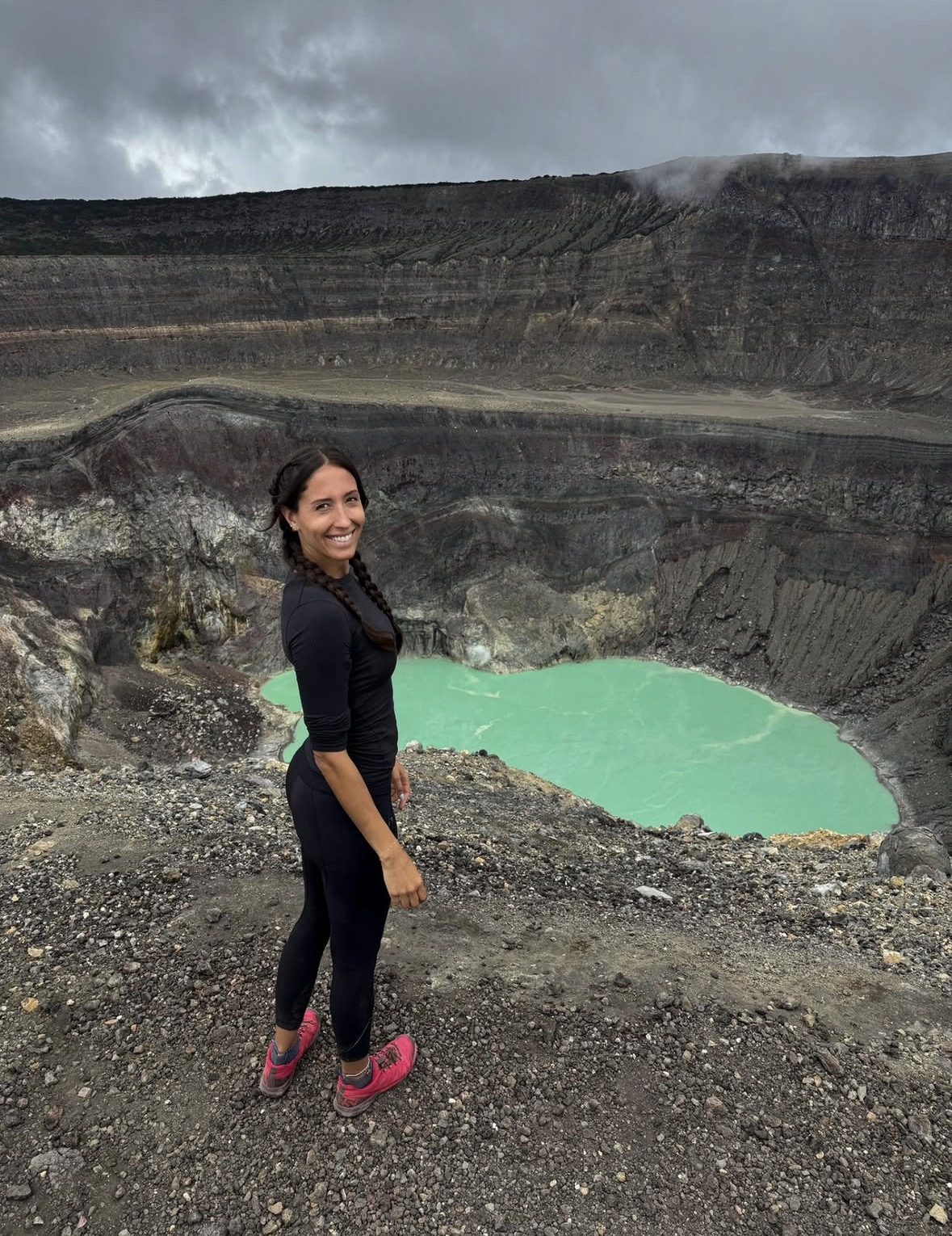
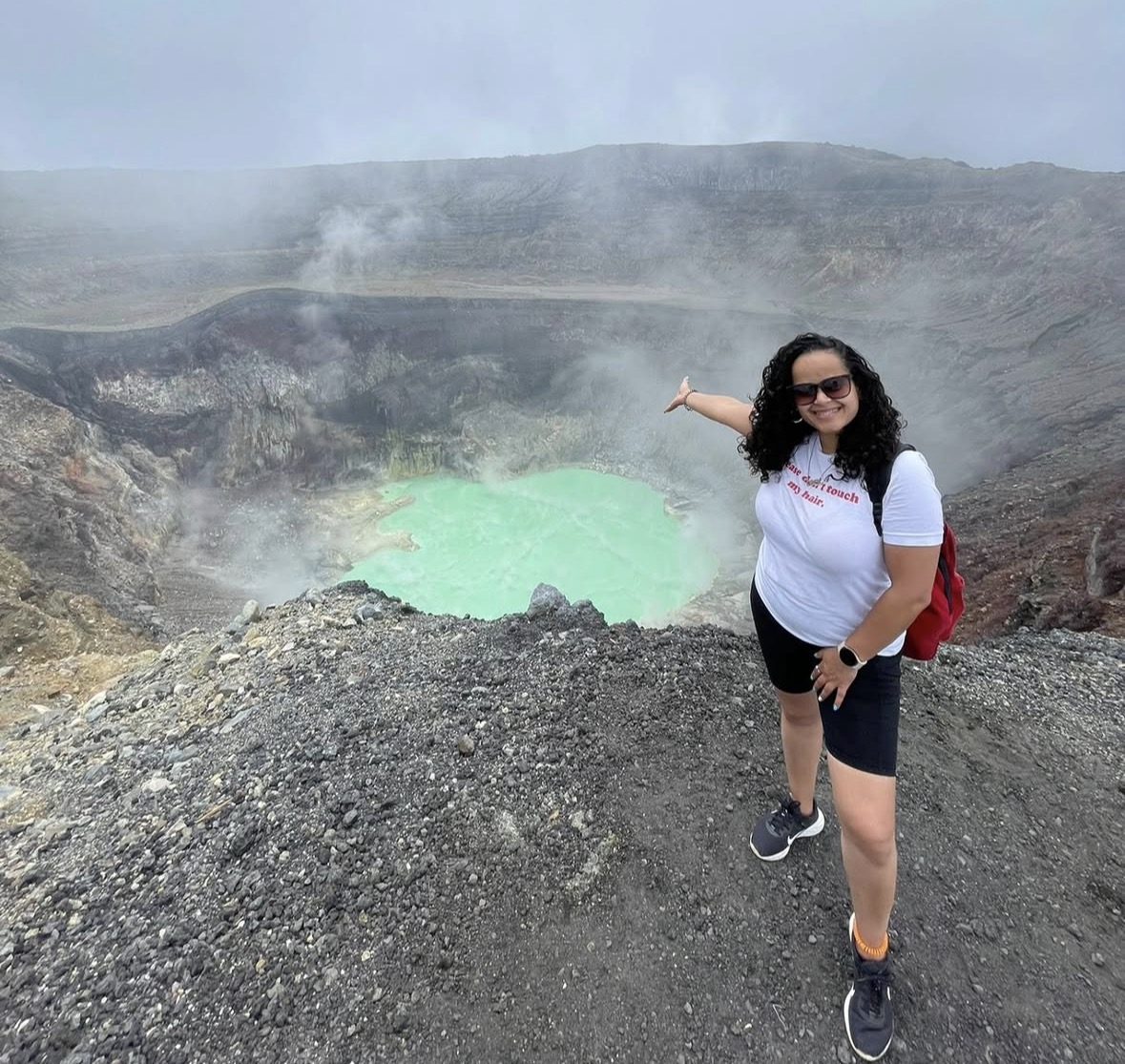
Throughout the colonial period, the volcano served as a navigational and psychological landmark for settlers, missionaries, and traders moving through the western highlands. Jesuit priests documented the volcano's visible fumarolic activity in the seventeenth century, noting persistent sulfurous emissions from the crater that local communities interpreted as omens. The acidic turquoise crater lake — one of the volcano's most arresting features — was referenced in early colonial manuscripts as a source of both wonder and dread. Coffee cultivation, introduced to the slopes in the nineteenth century during El Salvador's Liberal Reform era, transformed the middle elevations of Santa Ana into some of the most productive and economically vital agricultural land in the entire country.
The twentieth century brought renewed scientific attention to Santa Ana as volcanology emerged as a formal discipline and El Salvador's government began recognizing the need to monitor its volatile geological heritage. The volcano erupted significantly in 1904 and again in 1920, sending ash columns over the western highlands and reminding a rapidly modernizing nation that the earth beneath its coffee plantations remained dangerously alive. In 1958, El Salvador established Cerro Verde National Park, incorporating Santa Ana into a protected area that also encompassed Izalco and the scenic Lago de Coatepeque caldera lake below. This conservation move was as much about tourism potential as ecological preservation, signaling an early official acknowledgment of the volcano's extraordinary appeal.
The most dramatic recent chapter in Santa Ana's history was written on October 1, 2005, when the volcano unleashed its most powerful eruption in over a century. The explosion sent a pyroclastic column rising approximately 9 kilometers into the atmosphere and generated lahars — fast-moving volcanic mudflows — that swept down the southern and western flanks, destroying homes and agricultural land in nearby communities. Approximately 5,000 residents were evacuated from surrounding villages. Two people were killed by falling volcanic rocks ejected during the initial blast. The eruption prompted an urgent reassessment of monitoring infrastructure across El Salvador and drew international scientific missions to the site in the months and years that followed.
Following the 2005 eruption, Salvadoran authorities undertook significant investment in volcanic monitoring equipment, early warning systems, and community disaster preparedness programs around the Santa Ana complex. The national civil protection agency established clearer protocols for summit access, and guided hiking — which had been informally practiced for decades — was formalized under a permit and escort system requiring visitors to hike with authorized police and park guides. Paradoxically, the eruption amplified international interest in the volcano: travel journalists and adventure tourism operators took notice, and Santa Ana's summit hike began appearing on regional bucket lists, accelerating its transformation into one of Central America's premier volcano trekking destinations.
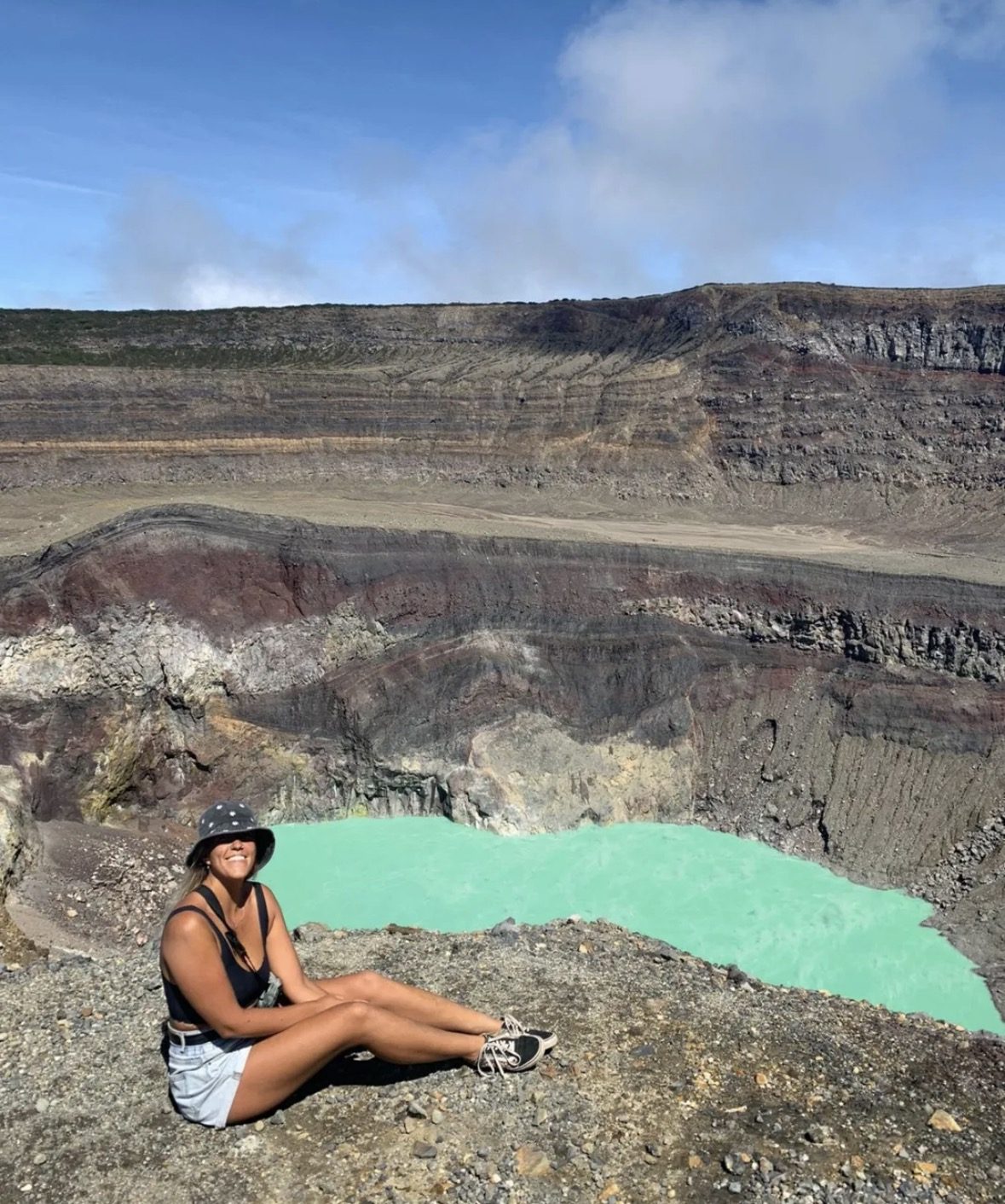
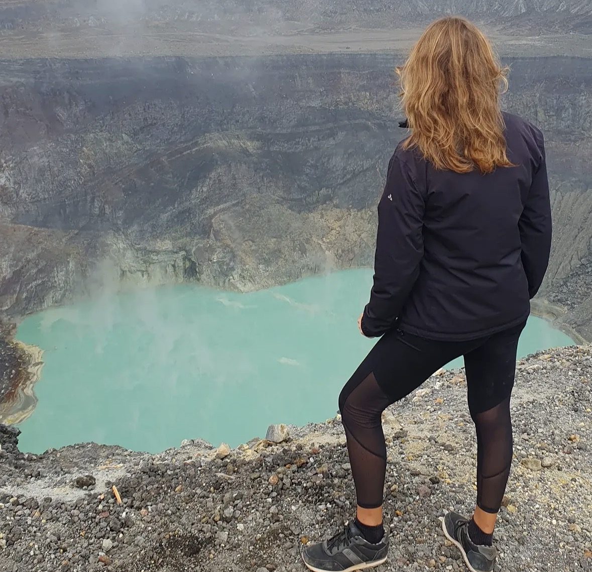
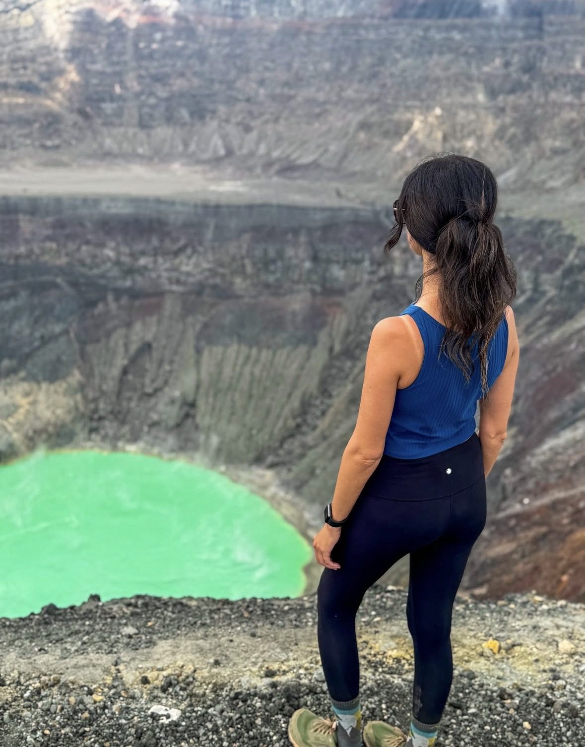
Today, Santa Ana Volcano draws thousands of hikers annually, particularly between November and April when the dry season delivers clear skies and optimal crater views. The standard route departs from the Cerro Verde National Park trailhead and winds approximately 4 kilometers through cloud forest and open volcanic terrain to the crater rim, where hikers are rewarded with a breathtaking panorama encompassing the sulfurous turquoise crater lake far below, neighboring Izalco's cone, the shimmering expanse of Lago de Coatepeque, and on clear days the distant Pacific Ocean. Guided groups depart every Saturday and Sunday morning under mandatory police escort, a safety measure that also provides visitors with knowledgeable local guides who interpret the volcano's geology and human history.
Standing on the crater rim of Ilamatepec, you are simultaneously at the highest point in El Salvador and at the intersection of millions of years of geological drama, centuries of indigenous reverence, colonial transformation, and living volcanic power. The acidic lake far below — its otherworldly color shifting from turquoise to emerald depending on sulfur concentrations and light — is a reminder that this mountain is not a relic but an active participant in the landscape. Whether you are a seasoned volcano trekker or a first-time adventurer drawn by the promise of one of Central America's most spectacular summit views, Santa Ana Volcano offers an experience that is equal parts physical challenge, natural spectacle, and profound historical encounter.
Ready to Experience It Yourself?
Don't leave this once-in-a-lifetime summit experience to chance — book a guided Santa Ana Volcano trek through a trusted local operator who knows every switchback, viewpoint, and story the mountain has to tell. Spaces on weekend guided hikes fill quickly, especially during peak dry season months, so securing your spot in advance is essential. Browse our hand-picked tour partners below and take the first step toward standing on El Salvador's highest peak.
Book Your Tour Now